
Drones are a transformational technology, perhaps most notably so within the Surveying & Mapping industry. By using a drone, surveyors no longer need to spend several days or weeks walking through the survey area and taking manual measurements. Not only do drones make surveying jobs easier, but they can also produce data and models that are more accurate.
Adding drones into your surveying & mapping operations is a no-brainer, but which drone do you pick? Which is most suited to your needs?
We've covered the five best drones for surveying & mapping on the market to help you answer that question.
1. DJI Phantom 4 RTK
Introduction:
With a built-in flight planning app (GS RTK) and an easy method to collect RTK data (RTK Network or D-RTK 2 Mobile Station), pilots have a full solution for any surveying, mapping or inspection workflow – right out of the box.
Video:
2. Yuneec H520 RTK
Introduction:
The H520E/520 is designed with the inspection industry in mind with six-rotor systems that allow for stable, precise flight, long focal-length lenses that allow the sUAS to fly at a greater distance from an object and data storage that may be shared instantly from the ST16S/E Ground Station or delivered directly in 4K/2K/HD video or 20 Mp still images.
Video:
3. Parrot Anafi
Introduction:
The Parrot Anafi started as a decent consumer drone, but Parrot has since launched versions that cater to the commercial market. The Anafi has a neat trick that you may not need for mapping, it can point the camera straight up. Though a niche feature, looking up is invaluable to some inspection tasks, and may prove useful to your mapping needs.
Video:
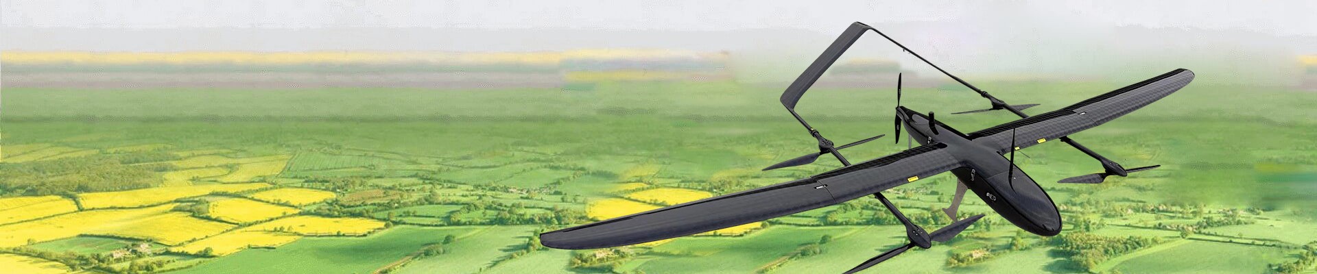
4. senseFly eBee X
Introduction:
Few companies have as much experience in aerial mapping as senseFly, so it only makes sense for one of their drones to be included in this list. Our choice is the eBee X, a fixed-wing drone that offers enough flexibility for any mapping needs.
The eBee X is an extremely versatile drone. It can accommodate both PPK and RTK workflows and is compatible with a wide range of payload options both from senseFly and third-party companies. These include the SODA 3D mapping camera and the Parrot Sequoia multispectral sensor, among others.
Video:
5. ASY
Introduction:
The new EPP foam is very strong, the strength is 3 times that of the original EPO foam, anti-friction, anti-fall. The size of the fuselage is further reduced, and it can be easily put into the trunk of the car after being placed in the storage box.
KOALA VTOL
Based on the user's portability requirements, is an all new design of the aircraft.
Elephant VTOL
Tool-less disassembly and assembly, vertical take-off and landing, long endurance, multiple loads.
Video:
6. What to look for in a mapping and surveying drone
1. Mechanical Shutter
If you are doing drone mapping professionally you should prioritize a drone that has a mechanical shutter. It is possible to create drone models from basically any drone, but if it doesn’t have a mechanical shutter the quality will suffer and it will take a much longer time to map the area.
2. Fixed-wing vs Multirotor
Multirotor drones are much easier to fly and maneuver, mostly because they can hover in place. If you’re surveying an area that only measures a few acres wide, then a multirotor drone may be the practical choice.
Fixed-wing drones truly shine if you are surveying a few hundred hectares of land. The design of fixed-wing drones allows them to generate lift by the mere act of gliding through the air.
3. Autonomous flight capability
More often than not, aerial mapping surveys will require that you fly over an area multiple times to ensure data consistency and accuracy. To do this, you must ensure that the drone flies along the same flight path every single time. Doing this manually is virtually impossible, so you’re going to need to use a drone that can be programmed for autonomous flight.
4. Long battery time
It’s not unusual for mapping surveys to cover areas that are several hectares large. Even with the speed with which drones can fly, a standard drone can’t finish an entire survey on a single battery cycle. Thus, there will certainly be a need for the drone to fly back to a designated landing spot so that its batteries can be swapped.
As you can imagine, landing and deploying the drone multiple times in a single survey will take lots of precious minutes. To optimize the time that you spend in the field, you will want a drone that can fly for at least 30 minutes uninterrupted. This is pretty much a standard number for most modern drones.
5. 4K camera
The key to data quality in photogrammetry is the resolution of the camera. You will want to use a camera that can capture as many of the fine details on the ground as possible, allowing the software to recreate these features during 3D modeling. Cameras that can capture 4K videos and 12 MP photos are standard nowadays, but you can go for as high a resolution as available.
6. RTK compatibility
All drones that are commercially available today come with a built-in GPS receiver to allow for locational tracking. This GPS feature provides flight stabilization as well as the tracking that the drone needs for autonomous flight. When doing mapping surveys, the GPS receiver also automatically geotags photos. By embedding the photos with spatial data, the mapping software can recreate an entire 3D model by “stitching” the photos together.
